Laser Scanning Surveys
High-Accuracy 3D Scanning Data
Get a Free Quote From Us Today!
We aim to get back to you in 24 hours.
At Laser Scanning Surveys, we specialise in delivering precise 3D laser scanning for buildings, structures, and sites across the UK. Our scanning technology captures detailed spatial information, allowing us to create accurate point clouds, measured drawings, and 3D models. These deliverables are invaluable for design and construction projects, enabling seamless planning and execution.
Contact us today to explore how our services can support your next project.
Who Is Laser Scanning Surveys?
We’re Laser Scanning Surveys, a leading provider of 3D laser scanning services throughout the UK. Our expertise lies in capturing high-detail spatial data for various types of buildings and structures. We employ advanced equipment such as terrestrial laser scanners and LiDAR (Light Detection and Ranging) technology, which provide accuracy to within millimetres.
This data is transformed into point clouds and 3D models, enabling architects, engineers, and construction professionals to work with accurate and reliable data. Our services are essential for projects ranging from historical building restoration to large-scale infrastructure development.
We follow industry standards like PAS 1192-2 for BIM (Building Information Modelling), ensuring compliance and enhancing project collaboration. Our clientele includes real estate developers, surveyors, and museums, each benefiting from our data solutions.
This ensures precision in design and efficiency in construction workflows. Whether it’s reducing project timelines or improving safety analysis, we support your project every step of the way.
What Laser Scanning Services Does the company Laser Scanning Surveys Provide?
Laser Scanning Surveys offers a range of 3D laser scanning services to meet diverse project needs, using the latest technology to ensure precision and reliability.
- Point Cloud Generation: Capture precise spatial data to create detailed point clouds. We use high-resolution LiDAR sensors to scan sites efficiently, ensuring minimal disruption to ongoing operations.
- Measured Drawings: Produce accurate drawings for design and documentation. Our team can deliver architectural, structural, and engineering drawings adhering to industry standards like RICS and BSI.
- 3D Modelling: Develop realistic 3D models to aid visualisation and planning. We specialise in BIM (Building Information Modelling) for enhanced project management and collaboration among stakeholders.
- Survey Deliverables: Customisable formats tailored to your project requirements. We offer deliverables in various formats, including DWG, PDF, and IFC files, integrating seamlessly with AutoCAD and Revit.
Our services cater to a wide range of clients, from architects and engineers to construction firms and heritage conservationists. Contact us to discuss your specific project needs.
When Is Laser Scanning Needed?
Laser scanning is essential when high accuracy is required in measuring existing conditions of structures or sites. Our technology is particularly useful for historical buildings, complex geometries, or areas that are difficult to access.
For example, capturing the precise dimensions and details of intricate Gothic architecture or tight urban environments can be challenging using traditional methods.
Laser scanning is also invaluable during construction and engineering projects for producing BIM (Building Information Modelling) and CAD drawings, ensuring all elements are spatially coordinated. In industrial sites, laser scanning can map out piping systems or mechanical setups with precision, allowing for clash detection and reducing the risk of construction delays.
When embarking on a renovation, restoration, or new construction project, precise 3D data ensures all design decisions are based on actual site conditions, minimising costly errors. For thorough and reliable measurements, contact us today to discuss your laser scanning needs.
Get a Free No Obligation Quotation Today
How Does Laser Scanning Surveys Work?
We follow a detailed process to ensure the highest level of precision in our laser scanning services. Our approach begins with an initial consultation, where we discuss your project needs and objectives with our team.
We take into consideration the type of property, whether commercial, residential, or industrial, and detail specific requirements such as building layouts, facades, or topographic features.
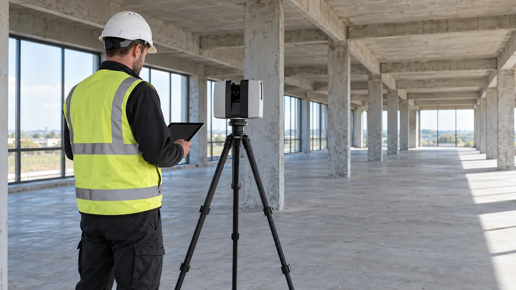
Next, we conduct a thorough site survey using our laser scanning equipment, such as terrestrial laser scanners with a range of up to 350 metres. These scanners capture high-density point clouds with millimetre-level accuracy, adhering to standards such as ISO 17123-8.
This ensures we gather highly accurate spatial data while minimising site disruption.
Once the data collection is complete, we move to data processing, converting raw scan data into actionable deliverables like point clouds and 3D models. We use specialised software such as Autodesk ReCap or Leica Cyclone to process these into formats like DWG or OBJ that align with your project specifications.
Finally, we provide deliverables in the desired format, ensuring they meet your project specifications. Our timely delivery supports your project’s timelines and helps you make informed decisions with precise datasets.
If you have any questions or require a quote, don’t hesitate to contact our team.
Who Does Laser Scanning Surveys Help?
Our laser scanning services support a broad range of professionals in the architecture, engineering, and construction sectors. Architects benefit from our 3D point cloud data, which aids in developing comprehensive Building Information Models (BIM) for renovations and new constructions.
Engineers rely on our precise measurements, with accuracy down to millimetres, ensuring compliance with ISO 9001:2015 standards for project precision. Construction managers use our data to effectively coordinate site logistics and schedule, identifying potential clashes through clash detection software.
Additionally, surveyors find our digital terrain models (DTM) invaluable for topographical assessments, while heritage conservationists use our scans to document and preserve landmark buildings. Whether handling residential, commercial, or industrial projects, we ensure that everyone involved has access to the exact data needed for success.
Contact us to see how our services can support your project’s unique needs.
How Quickly Can Laser Scanning Surveys Respond?
At Laser Scanning Surveys, we pride ourselves on our flexible and responsive approach to client needs. Our team can often arrange site surveys within two to three days, depending on location and requirements.
We employ Trimble and Leica laser scanners, which provide high-resolution data quickly, enabling us to process and deliver results efficiently. Typical deliverables, such as point clouds or 3D models, are prepared and shared within one to two weeks, taking into account factors like site size and terrain conditions.
Additionally, we adhere to relevant industry standards such as RICS for land surveying, ensuring high accuracy and consistency in our results. Our services cater to various sectors, including construction, architecture, and environmental planning.
Get in touch to discuss how we can meet your timeline.
How Does Laser Scanning Surveys Ensure Quality and Compliance?
We adhere to strict industry standards, ensuring every project meets the RICS (Royal Institution of Chartered Surveyors) guidelines. Our team is skilled in using the latest 3D scanning technology, including LiDAR (Light Detection and Ranging) and terrestrial laser scanners, which ensures that we deliver accurate and verified data.
We use software such as AutoCAD and Revit to process and transform data into usable models, which helps us maintain precision and reliability.
Compliance with industry standards is paramount, and we consistently strive to exceed these expectations. We also align with ISO 9001 standards to enhance our quality management system, covering aspects like project documentation and client communication.
Our services cater to diverse sectors, including retail, industrial, and residential projects, providing detailed topographic and structural assessments. Clients can rely on us for meticulous site evaluations that adhere to both safety and environmental regulations.
Request a free quote
Why Choose Laser Scanning Surveys?
Choosing Laser Scanning Surveys means partnering with a team dedicated to precision and reliability. Our expertise lies in using the latest technology and methods to deliver unparalleled results.
Here are some reasons to consider us for your next project:
- State-of-the-Art Equipment: We use the latest 3D laser scanning tools, such as LiDAR and terrestrial laser scanners, which provide millimetre-level accuracy for measurements and detailed data capture.
- Experienced Team: Our professionals are highly skilled in 3D surveying across various sectors, including construction, architecture, and heritage preservation, and are trained in following RICS standards for surveying.
- Customisable Deliverables: We tailor outputs to fit the specific needs of your project, offering services such as 3D BIM models, point cloud data, and floor plans, which can be integrated into existing digital workflows.
- Comprehensive Service: Our end-to-end service covers everything from site survey to data delivery, ensuring timely completion and adherence to client specifications while solving complex geometrical and spatial challenges.
Our commitment ensures that your project needs are met with precision and expertise. Let us help you with your surveying requirements.
Frequently Asked Questions
What is 3D laser scanning?
3D laser scanning is a technology that uses laser beams to capture spatial data of buildings and sites. It creates accurate 3D models and point clouds for use in various applications.
How accurate is the scanning data?
The accuracy of our laser scanning data typically falls within millimetres, making it ideal for precision-focused projects.
What types of projects benefit from laser scanning?
Projects such as architectural restorations, structural assessments, and new builds benefit from laser scanning, which provides precise site data.
How are the deliverables provided?
We provide deliverables in a variety of formats, including CAD drawings, PDFs, and 3D models, ensuring compatibility with your project requirements.
Can you handle large-scale sites?
Yes, we regularly undertake large-scale projects and have the equipment and expertise to manage extensive sites effectively.
Get a Free Quote
Explore the benefits of precise 3D laser scanning for your next project. today.
speak with our team today
What People are Saying About Us
★★★★★
“Laser Scanning Surveys gave us a clean 3D model of the whole building, and it looked brilliant. Really pleased, it will save us so much hassle.”
Amara Brennan
London
★★★★★
“Laser Scanning Surveys were far less disruptive than I expected in our working premises. The technicians were courteous, careful and kept our staff informed all day.”
Liam Whittle
London
★★★★★
“Laser Scanning Surveys were far better than I had expected, a lovely and helpful team who made everything easy.”
Kieran Sinclair
London
★★★★★
“Delighted with the laser scan from Laser Scanning Surveys. Quick, tidy and friendly. Would use them again.”
Zara Bennett
London
Our Locations
We are proud to work nationally across the UK, allowing us to ensure we can provide services to you.
For a full list of counties we cover in the UK, see below.